

£ 344.70
Price includes
Import Duties and Taxes. Free shipping available
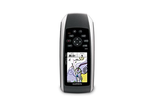
GarminGPS 78sc Waterproof Marine GPS and Chartplotter
Easy Returns with desertcart PRO
30 day return window
Free replacements & exchanges
Hassle free one-click returns
About the item
- Marine-friendly handheld with high-sensitivity GPS receiver and 2.6-inch color TFT display.
- Perfect for boating/watersports--waterproof to IPX7 standards; floats in water.
- Built-in BlueChart g2 U.S./Bahamas coastal charts with shorelines, depth contours, navaids, harbors, marinas, and more.
- Built-in 3-axis tilt-compensated electronic compass and barometric altimeter for heading/altitude/weather.
- Share your waypoints, tracks, routes and geocaches wirelessly with other compatible device user.
Frequently Asked Questions About GarminGPS 78sc Waterproof Marine GPS and Chartplotter in GB
Where can I buy GarminGPS 78sc Waterproof Marine GPS and Chartplotter online at the best price in the GB?
desertcart is the best online shopping platform where you can buy GarminGPS 78sc Waterproof Marine GPS and Chartplotter from renowned brand(s). desertcart delivers the most unique and largest selection of products from across the world especially from the US, UK and India at best prices and the fastest delivery time.
Is GarminGPS 78sc Waterproof Marine GPS and Chartplotter available and ready for delivery in GB?
desertcart ships the GarminGPS 78sc Waterproof Marine GPS and Chartplotter to London, Birmingham, Manchester, Leeds, Newcastleand more cities in GB. Get unlimited free shipping in 164+ countries with desertcart Plus membership. We can deliver the GarminGPS 78sc Waterproof Marine GPS and Chartplotter speedily without the hassle of shipping, customs or duties.
Does desertcart have 100% authentic GarminGPS 78sc Waterproof Marine GPS and Chartplotter online?
desertcart buys GarminGPS 78sc Waterproof Marine GPS and Chartplotter directly from the authorized agents and verifies the authenticity of all the products. We have a dedicated team who specialize in quality control and efficient delivery. We also provide a free 14 days return policy along with 24/7 customer support experience.
Is it safe to buy GarminGPS 78sc Waterproof Marine GPS and Chartplotter on desertcart?
Yes, it is absolutely safe to buy GarminGPS 78sc Waterproof Marine GPS and Chartplotter from desertcart, which is a 100% legitimate site operating in 164 countries. Since 2014, desertcart has been delivering a wide range of products to customers and fulfilling their desires. You will find several positive reviews by desertcart customers on portals like Trustpilot, etc. The website uses an HTTPS system to safeguard all customers and protect financial details and transactions done online. The company uses the latest upgraded technologies and software systems to ensure a fair and safe shopping experience for all customers. Your details are highly secure and guarded by the company using encryption and other latest softwares and technologies.